Introduction
The development of a solar project — whether a 500 kW rooftop installation or a 50 MW ground-mounted facility — begins with a question that is deceptively simple: what exactly does the site look like? Answering that question accurately and comprehensively has historically required significant time, cost and human effort. Today, drone technology has fundamentally changed that calculus.
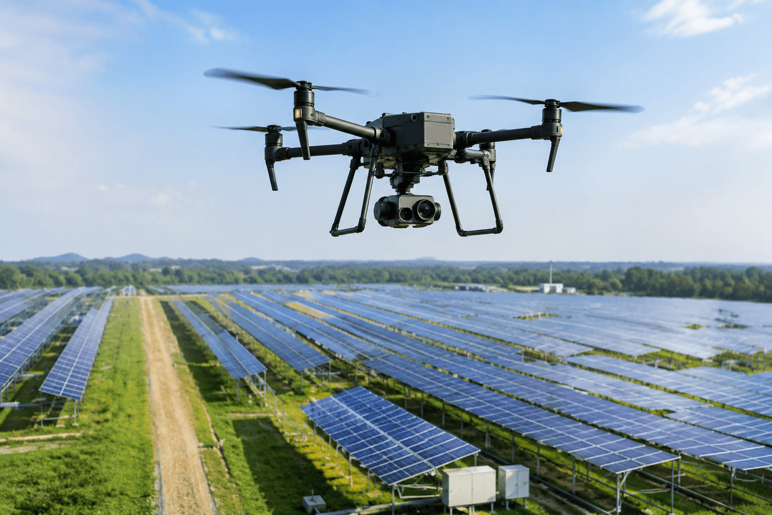
Unmanned Aerial Vehicles (UAVs), commonly known as drones, equipped with high-resolution cameras, LiDAR sensors, multispectral imagers and thermal cameras are transforming how solar projects are surveyed, designed, built and maintained. For project developers, EPC contractors and asset owners, understanding the capabilities and applications of drone technology is increasingly a commercial necessity, not merely a technical curiosity.
The Limitations of Traditional Survey Methods
Before evaluating what drones offer, it is useful to understand what they replace. Traditional site survey methods for solar projects rely on:
Ground-based topographic surveys using total stations or GPS instruments, which are labor-intensive, time-consuming and limited in spatial coverage per day
Manual visual inspection of panels requiring technicians to walk every row of a solar farm — a process that may take days for large installations and creates safety risks
Satellite imagery, which offers broad coverage but limited resolution, outdated capture dates and no ability to collect thermal or structural data
Helicopter surveys, which provide aerial perspective but at prohibitive cost and with limited data capture capability
For a 10 MW ground-mounted facility, a comprehensive traditional topographic survey might require 5 to 10 days of field work and significant post-processing time. The same data can be captured by a drone survey team in a single day with superior accuracy and far richer data output.
Drone Mapping and Topographic Surveys
Modern survey drones equipped with high-resolution cameras and GPS receivers fly pre-programmed grid patterns over the survey area, capturing hundreds or thousands of overlapping images. Photogrammetry software — such as Pix4D, DroneDeploy or Agisoft Metashape — processes these images to generate:
Orthomosaic maps: High-resolution, geometrically corrected aerial images accurate to 2 to 5 centimeters per pixel
Digital Elevation Models (DEM): Point cloud-based terrain models capturing every undulation in the landscape
Contour maps: Automatically generated elevation contours supporting drainage analysis and mounting structure design
Volumetric calculations: Accurate measurement of earthwork quantities for ground-leveling operations
For solar project development, this data directly informs panel layout optimization, inter-row spacing calculations to minimize shading, access road routing, cable trenching paths and substation positioning.
3D Modeling and Site Visualization
Drone-captured data enables the generation of detailed 3D models of both the terrain and any existing structures on the site. For rooftop solar projects, 3D models of the building and its roof geometry provide:
Precise roof area measurement and tilt angle verification
Identification of obstructions — water tanks, HVAC units, ventilators — and their shadow impact modeling
Virtual walkthroughs for client presentations and engineering review
Integration with solar design software for accurate generation yield simulation
For ground-mounted projects, terrain-following 3D models eliminate the need for extensive manual surveying of every micro-topographic feature, enabling precise pile design and reducing material costs through optimized row spacing.
Thermal Imaging for Solar Panel Inspection
Thermal infrared cameras mounted on drones represent one of the most powerful applications in the solar industry. Solar panels generate heat as a byproduct of energy conversion, and thermal anomalies — hotspots — indicate defects, degradation or soiling patterns that reduce output and, in some cases, create fire hazards.
What Thermal Drone Surveys Detect
Hotspot defects: Individual cells or bypass diodes overheating due to internal defects, physical damage or partial shading
Diode failures: Bypass diodes that have short-circuited, causing entire cell strings to underperform
String-level faults: Disconnected strings or wiring faults visible as entire rows of thermally abnormal panels
Soiling patterns: Differential dust accumulation creating non-uniform generation loss across the array
Delamination and moisture ingress: Structural module degradation visible as thermal anomalies
A thermal drone survey of a 1 MW installation can be completed in 2 to 4 hours, covering 1,000 to 1,500 panels. Manual thermal inspection of the same plant using handheld thermal cameras would take 2 to 3 days and would be practically impossible to complete systematically in large-scale facilities.
Construction Planning and Progress Monitoring
Drone surveys are not limited to pre-construction and operations phases. During construction, regular aerial surveys provide:
Progress documentation: Timestamped orthomosaic maps showing construction progress for project management and stakeholder reporting
Quality control: Verification that mounting structures, cable routes and panel layouts match design specifications
Material quantity verification: Confirmation that installed quantities match procurement records
Safety monitoring: Identification of safety protocol compliance issues across large construction sites
Real-World Industrial Applications
The practical impact of drone survey technology is well-established across diverse industrial solar contexts:
Large Ground-Mounted Utility and C&I Solar Parks
For a 20 MW ground-mounted facility in Rajasthan, a drone topographic survey reduced the pre-design survey phase from three weeks to three days, with output accuracy exceeding that of traditional GPS-based surveys. The resulting digital terrain model identified a drainage channel that would have required significant earthwork to manage — a discovery that saved substantial construction costs.
Industrial Rooftop Installations
For a pharmaceutical manufacturer evaluating a 3 MW rooftop installation across five buildings, drone survey and 3D modeling of the roof complex reduced the design phase by 40 percent compared to manual measurement methods, and identified structural issues on one building that required remediation before solar installation could proceed.
Operational Solar Farm O&M
Annual thermal drone surveys of an operating 50 MW solar park identified 127 panel-level hotspots and 8 complete string failures in a single day of flight operations. The same inspection conducted manually would have required over two weeks and would have missed subtle thermal anomalies detectable only through systematic thermal analysis.
The Future: AI and Drones in Renewable Energy
The integration of artificial intelligence with drone survey data is accelerating capabilities across the renewable energy sector:
Automated defect classification: Machine learning models trained on thousands of thermal images can automatically identify and categorize panel defects with accuracy exceeding manual analysis
Predictive maintenance: AI analysis of recurring thermal survey data can identify degradation trends before they result in significant output loss or system failure
Digital twins: Comprehensive drone-captured 3D models combined with real-time performance data enable digital twin models of solar assets for advanced simulation and optimization
Autonomous inspection drones: Fully autonomous inspection missions, triggered by performance analytics or scheduled intervals, are becoming commercially available for large solar installations
As AI capabilities advance and drone hardware costs continue to decline, the technology is moving from specialist service to standard practice across the solar industry — a transition that will raise baseline expectations for project quality and operational visibility.
Key Takeaways
Drone surveys reduce project survey time by 60 to 80 percent compared to traditional methods while delivering superior data quality.
Thermal drone inspections can cover a 1 MW plant in hours, identifying defects that manual inspection would miss.
3D modeling from drone data improves design accuracy and eliminates costly surprises during construction.
AI integration is transforming drone data into predictive intelligence for proactive asset management.
Drone technology is rapidly becoming a standard requirement for quality solar project development and O&M.
Frequently Asked Questions
Q1: How accurate are drone topographic surveys for solar project planning?
Modern photogrammetry-based drone surveys achieve horizontal accuracy of 2 to 5 cm and vertical accuracy of 3 to 8 cm under standard operating conditions with ground control points. LiDAR-equipped drones achieve even higher accuracy, often sub-centimeter in controlled conditions. This accuracy level substantially exceeds the requirements for solar project planning and is comparable to professional ground-based total station surveys at a fraction of the time and cost.
Q2: What regulations govern commercial drone operations in India?
Commercial drone operations in India are regulated by the Directorate General of Civil Aviation (DGCA) under the Drone Rules, 2021. EPC and survey firms must obtain a Remote Pilot Certificate (RPC) for operators, register drones on the Digital Sky platform, operate within approved flight zones and comply with altitude, distance and operational restrictions. Projects near airports, defense installations or national borders require additional clearances. Ensure your drone survey provider maintains full DGCA compliance documentation.
Q3: Can drone thermal surveys replace manual O&M inspections entirely?
Thermal drone surveys complement rather than entirely replace ground-based maintenance activities. Drones excel at systematic, large-scale thermal anomaly detection and documentation. However, identified issues require physical access for diagnosis and repair — tightening connections, replacing junction boxes, cleaning modules or swapping defective panels. A best-practice O&M program combines quarterly or semi-annual thermal drone surveys with targeted ground-based intervention based on survey findings.
Q4: What data formats are delivered from a drone survey and how are they used?
A comprehensive drone survey delivers orthomosaic images in GeoTIFF format, Digital Elevation Models as point clouds (LAS/LAZ) or rasters, 3D models exportable to common CAD formats, and thermal images in RJPEG or TIFF format with embedded radiometric data. These outputs integrate directly with solar design software (PVsyst, Helioscope, AutoCAD), GIS platforms and asset management systems, enabling seamless workflow from survey to design to commissioning.
Q5: How frequently should drone inspections be conducted on an operating solar plant?
For optimal asset performance management, thermal drone inspections should be conducted at minimum once annually, ideally during periods of high solar irradiance (October to February in most of India) for maximum defect detection accuracy. High-value or large-scale installations benefit from bi-annual surveys. Construction phase progress surveys should be conducted weekly or fortnightly depending on project scale and schedule criticality.
Conclusion
Drone survey technology has moved from innovative differentiator to operational standard in solar project development. Its ability to compress survey timelines, improve design accuracy, systematically identify operational defects and provide rich construction documentation has created measurable financial value across the solar project lifecycle.
For industrial organizations developing solar assets or managing operating solar portfolios, drone survey and inspection services are not an optional upgrade — they are a fundamental component of responsible asset development and management.